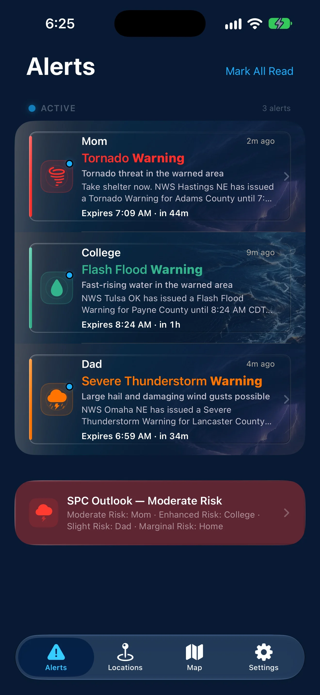
WeatherAlarm exists so you can stop worrying and start knowing — it watches your saved locations 24/7 and sends a push the instant severe weather threatens, with the storm's distance, heading, and minutes-to-impact for each place you watch.
Free · No ads · No account requiredWeatherAlarm is built for anyone keeping an eye on the people who matter to them — a parent tracking a kid away at college, a spouse away on a work trip, a sibling across the state — wherever they are, whatever the distance. It's the app I wanted to exist for my own family, built to be trusted.
Features
WeatherAlarm is focused on one job: making sure you know when severe weather is headed toward someone you care about.
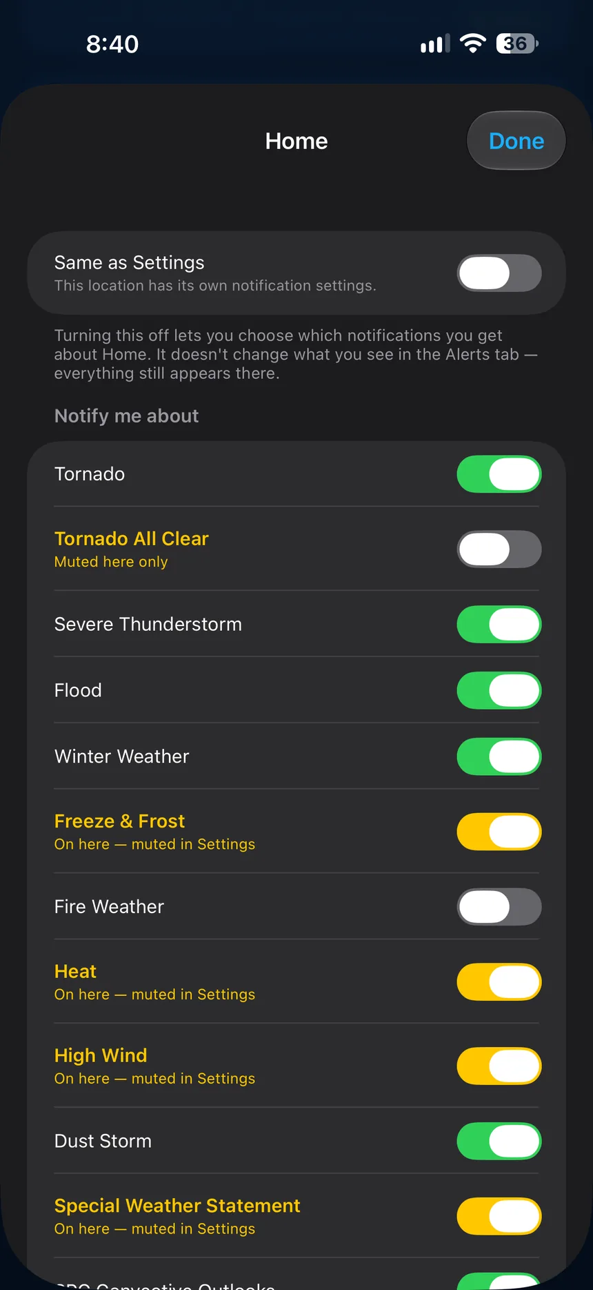
Everyone you watch over is different. Each of them can have their own alert settings — turn off the types that don't matter where they live, or turn on ones you've silenced everywhere else. Every alert still appears in the app; this only changes what interrupts you.
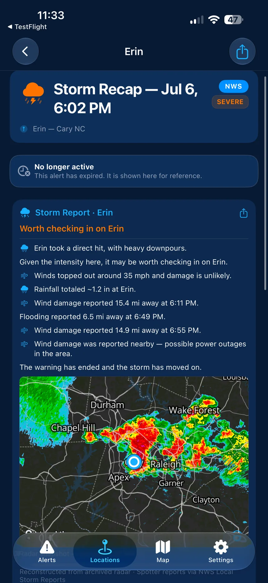
When a warning for someone you're watching expires, WeatherAlarm replays the storm's whole life at their exact address — not their county, their address — and gives you a plain answer: worth checking in, or they likely came through fine. Computed entirely on their phone.
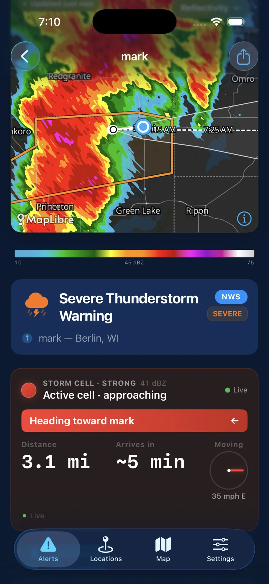
Every active warning shows the storm cell's distance, heading, and minutes-to-impact for each place you watch — right in the notification and on the alert screen. It refreshes every radar sweep, so you always know where the storm is relative to the people you love.
Text any warning, watch, or the day's severe-weather outlook to family and friends with one tap. They get a clean preview and a link that opens WeatherAlarm — or a web page if they don't have it yet. Because the whole point is the people you love.
Severe-thunderstorm warnings escalate through Considerable and Destructive; tornado warnings through Confirmed, Particularly Dangerous Situation, and Emergency. When a storm worsens, you get a fresh update — never silence.
Alerts for tornado warnings, severe thunderstorm warnings, winter storms, floods, and dozens of other NWS products — matched to each location by the official warning polygon, not just the county.
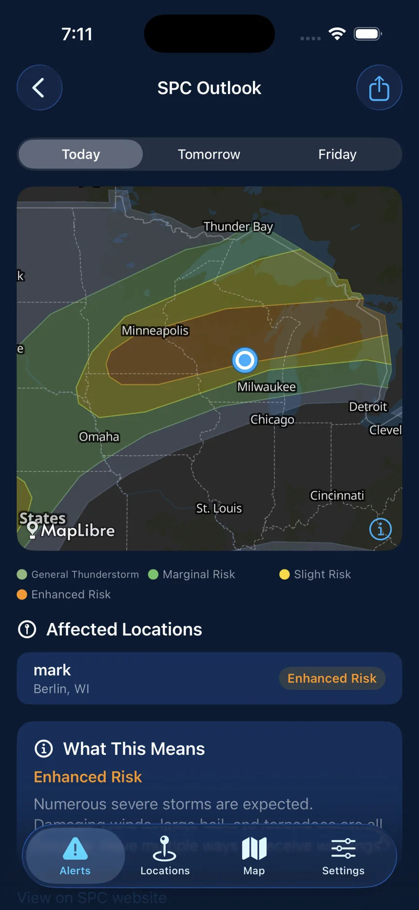
An interactive map of the Storm Prediction Center's Day 1–8 convective outlooks, with color-coded risk polygons and the locations each one affects.
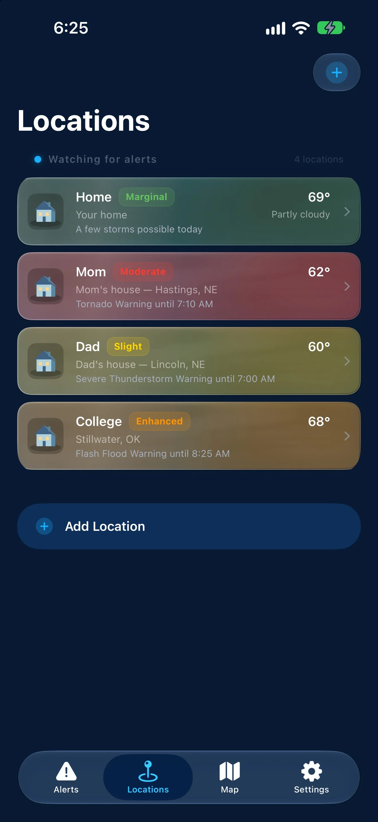
Monitor Mom, Dad, Grandma, the cabin — each labeled with a name you choose, not just an address. A place in another timezone shows in its own local time, not your phone's.
Tap any notification to see the full NWS alert — parsed into clear sections with hazard details, safety instructions, a live radar loop, and the affected area. Flood warnings show rainfall accumulation, so you see how much has fallen where it matters.
Every alert carries a plain-language explainer showing exactly why it reached you — which location matched, and how. No mystery notifications.
Alerts reach your lock screen typically under a minute from the moment NWS issues them — our own handling takes about a fifth of a second, and the rest is the wire — a real-time push feed (NWWS-OI) backed by a 60-second safety-net poll. The official NWS warning is always the authority.
Small, medium, and large widgets show your most urgent active alert at a glance — or a clear-skies state when nothing's active. Updates in the background; no need to open the app.
No account, no email, no ads, no tracking, no subscription. Your locations sync across your own devices — iPhone and Android — and otherwise stay yours.
Active wildfire perimeters and smoke-plume forecasts on the map, with the distance to the nearest active fire shown right on a location's own detail screen.
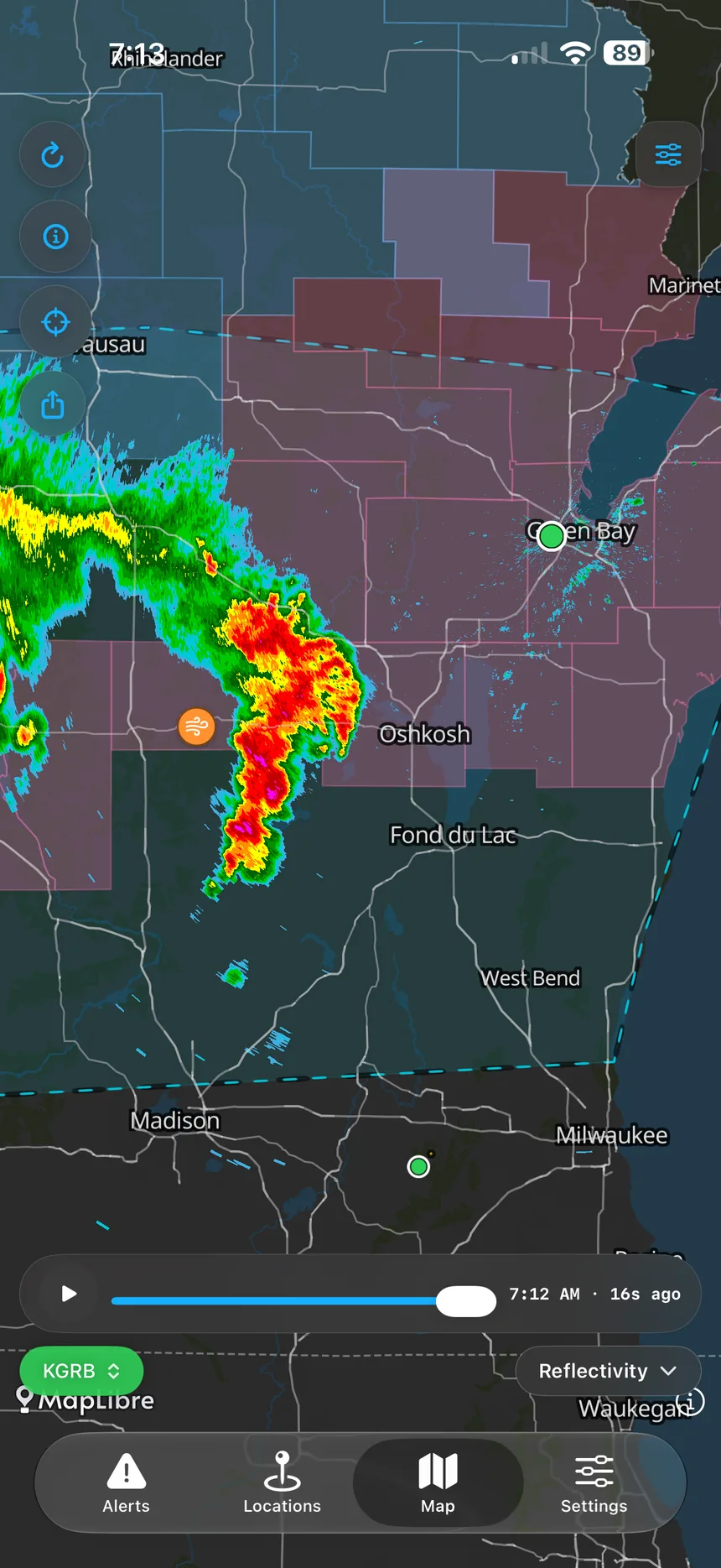
The same super-resolution radar your local NWS forecaster sees, decoded right on your phone — no streaming, no degraded mobile version. Reflectivity, velocity, storm-relative velocity, correlation coefficient with radar-confirmed tornado-debris detection, VIL, and Echo Tops — with a color-scale legend so every product is readable at a glance.
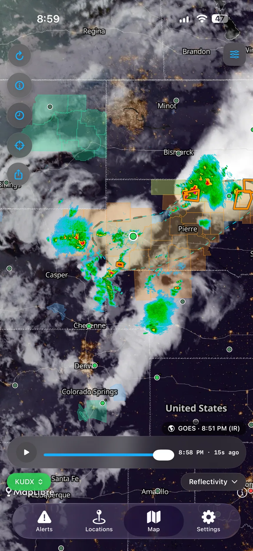
A self-hosted GOES satellite feed refreshed every few minutes — not the 30–60 minute-stale tiles most weather apps show — draped right over the radar and scrubbing through time right alongside it.
An 18-hour hourly forecast radar loop, so you can see where precipitation is expected to develop over the next day, not just where it is right now.
Rewind through a full day of archived radar and watch storms — with their cell markers and history trails — move through time. Long-press anywhere to read the exact value at that spot (“52 dBZ”, “3.2 in”), and share a loop as a video or still image, right from your phone.
On-device radar composites reveal the cumulative footprint of a storm's damaging hail and wind core — where the worst of it has tracked, estimated straight from the radar.
The app finds storm cells in the radar volume and projects each one's path with track cones and +5, +15, +30, and +60-minute horizon markers — so you see where a storm is headed, not just where it is.
During hurricane season, see the National Hurricane Center's forecast cone, track, and wind-speed probability on the map — plus storm-surge inundation in feet. Get notified the moment a loved one's address enters the forecast path.
See the EPA Air Quality Index for any location, color-coded exactly like AirNow, with a plain-language health note — one that accounts for smoke in the area even when the sensor itself still reads clean.
A full-screen map with togglable layers — warnings, watches, statements, SPC Day 1–8 outlooks, live Level II radar, storm tracks, Local Storm Reports, SPC Mesoscale Discussions, and your locations as pins. Long-press a pin to measure pin-to-pin distance; tap any polygon for parsed detail.
Version 2.4 is available now on the App Store and Google Play. Here are the newest ways WeatherAlarm helps you follow the people you love.
A loved one’s card can now tell you the lights are out where they are. Where a utility publishes street-level outages, WeatherAlarm says their own address looks affected; elsewhere it reports how much of the surrounding area is dark, always naming the utility the figures came from — and saying nothing at all rather than implying the power is on.
Power providers now open straight to that company’s own outage map rather than a web search, and the list names only the company that actually owns the poles — not resellers who cannot restore anything.
Give each location its own picture — choose and frame one yourself, or let it come across automatically when you pick someone from your contacts. Photos stay on the device and are never uploaded.
A new map layer carries NOAA’s probability of four or more inches of snow, and of a quarter-inch of ice, for each of the next three days — the winter counterpart to the severe-weather outlooks that only cover storm season.
A Snow Squall Warning now brings up live radar and the storm scrubber, exactly as a severe thunderstorm does — it is the one winter hazard that moves like one. Extreme cold and wind chill alerts read as winter too.
A live flood warning shows the nearest NOAA river gauge and where it stands. A gauge that is out of service or has stopped reporting says so plainly, instead of looking reassuringly calm.
When a warning expires, its card shows the National Weather Service storm reports filed near that loved one. If none have been filed it says so, and if the lookup fails it says that instead — because those are not the same thing.
When the day’s severe window crosses sunset at a watched location, WeatherAlarm says so. Overnight storms are the dangerous ones, because the people you are watching are asleep and cannot see them coming.
How it works
Search for any address, city, or ZIP code. Give it a label — "Mom's house", "College", "The cabin" — whatever makes sense to you.
WeatherAlarm receives National Weather Service warnings the moment they're issued, and checks NOAA's Storm Prediction Center for severe weather outlooks throughout the day — matching every alert against the locations you care about.
The moment severe weather is issued for one of your locations, you receive a push notification telling you exactly what it is, where, and how serious.
Tap a notification to see the full alert — the storm's distance, heading, and minutes-to-impact, a live radar loop, and plain-language safety instructions. Or open the app to see every active alert across your locations, sorted by severity.
Data Sources
Warnings, outlooks and radar come from the same authoritative sources professional meteorologists and emergency managers rely on. A few specialist layers come from named partners, listed here. Nobody’s personal data is bought or sold — ever.
From the developer
No company. No investors. No ads. Just an app I wanted to exist — and thought your family deserved.
I'm a single developer, not a company. I built WeatherAlarm because I wanted a severe-weather app I could actually trust to watch over the people I love — wherever they are — without ads, without selling anyone's data, and without a paywall standing between a family and a tornado warning.
So that's what this is: a genuinely better severe-weather app, built carefully, and given away free. No account required, no tracking, no catch. If it helps one family get to shelter a few minutes sooner, every late night was worth it.
— Jason, WeatherAlarm